 Web Front-end
 H5 Tutorial
 HTML5 geographical positioning Geolocation-API and Haversine geospatial distance algorithm (graphics and text)
HTML5 geographical positioning Geolocation-API and Haversine geospatial distance algorithm (graphics and text)
HTML5 provides Geolocation-API that allows us to obtain geographical location coordinates
However, it will only be used for specific needs
For example, map applications

Generally still rarely used
Geolocation-API
The method used is also very simple
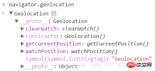
API exists on the prototype of the navigator.geolocation object

The core methods are getCurrentPostion and watchPosition
getCurrentPosition
navigator.geolocation.getCurrentPosition method has three parameters
success Get Callback function for successful location information (required)
error Callback function for failure to obtain location information
options Configuration information parameter object
navigator.geolocation.getCurrentPosition(function(pos){
console.log(pos);//获取位置信息对象Geoposition});At this time the browser will initiate a query<br/>Because after all location information is also considered private information

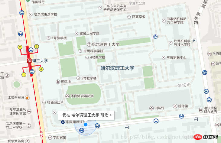
Here we click to allow sharing location information That’s it<br/>Then Chrome will send the local network information to Google location service<br/> (Since Google is blocked in China, we can only get the location information by overcoming the wall〒▽〒)

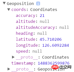
The location information that can be returned to us in the console
coord coordinates<br/>
accuracy Positioning accuracy (unit m)
altitude Altitude
altitudeAccuracy Altitude accuracy (unit m)
heading direction
latitude latitude
longitude longitude
speed speed
timestamp timestamp
<br/>
Copy after login
However, this coordinate is not very accurate (especially on PC) <br/>It may originate from IP address, GPS, Wifi positioning, etc.
navigator.geolocation.getCurrentPosition(function(pos){
  console.log(pos);
},function(err){
  console.log(err);
});We can set the second parameter to do some processing when obtaining the geographical location information error
navigator.geolocation.getCurrentPosition(function(pos){
  console.log(pos);
},function(err){
console.log(err); //获取错误对象PositionError});For example I'm refusing to share my location now

code = 1 means user refuses
code = 2 means unable Get
code = 3 indicates connection timeout
The third parameter is used to set configuration information
navigator.geolocation.getCurrentPosition(function(pos){
  console.log(pos);
},function(err){
  console.log(err);
},{
  enableHighAccuracy: true,
  timeout: 5000,
maximumAge: 3000});enableHighAccuracy Whether high-precision location is required, the default is false
timeout Set the request timeout (unit ms) The default infinity has no time limit
maximumAge Location information expiration time (unit ms) Default 0: Unconditionally obtain new geographical location information <br/>
When repeatedly obtaining the geographical location watchPosition, this parameter specifies how long it takes Get the position again
watchPosition
The watchPosition and getCurrentPosition parameters are the same<br/>The difference is that watchPosition continuously obtains position information<br/>For example The positioning software we use<br/>When our position keeps changing while running, we need to constantly redraw the positioning<br/>In this way, every time the coordinates change, the success callback function
will be called and watchPosiiton will return a watchID <br/>We can cancel monitoring through clearWatch(warchID)<br/>Similar to canceling the timer
var ID = navigator.geolocation.watchPosition(function(pos){  ...},function(err){  ...},{  ...});
navigator.geolocation.clearWatch(ID);If clearWatch does not take parameters<br/>, clear all watchPosition
Haversine algorithm
Sometimes we<br/>may need to get the distance between two points<br/>For example, for example, to get nearby businesses from a food ordering APP<br/>At this time we can use the Haversine algorithm to calculate

function toRadians(degree) {
  return degree * Math.PI / 180;
}function haversine(latitude1, longitude1, latitude2, longitude2) {
  var R = 6371;  var deltaLatitude = toRadians(latitude2-latitude1);
  var deltaLongitude = toRadians(longitude2-longitude1);
  latitude1 = toRadians(latitude1);
  latitude2 = toRadians(latitude2);
  var a = Math.sin(deltaLatitude/2) * Math.sin(deltaLatitude/2) +
  Math.cos(latitude1) * Math.cos(latitude2) *
  Math.sin(deltaLongitude/2) * Math.sin(deltaLongitude/2);
  var c = 2 * Math.atan2(Math.sqrt(a), Math.sqrt(1-a));
  var d = R * c;  return d;
} Pass in the coordinates of two points to get the geographical spatial distance
wherevar R = 6371; is the radius of the earth 6371km
Of course there are also some other algorithms
Varies in timing and accuracy
The above is the detailed content of HTML5 geographical positioning Geolocation-API and Haversine geospatial distance algorithm (graphics and text). For more information, please follow other related articles on the PHP Chinese website!

Hot AI Tools

Undresser.AI Undress
AI-powered app for creating realistic nude photos

AI Clothes Remover
Online AI tool for removing clothes from photos.

Undress AI Tool
Undress images for free

Clothoff.io
AI clothes remover

Video Face Swap
Swap faces in any video effortlessly with our completely free AI face swap tool!

Hot Article

Hot Tools

Notepad++7.3.1
Easy-to-use and free code editor

SublimeText3 Chinese version
Chinese version, very easy to use

Zend Studio 13.0.1
Powerful PHP integrated development environment

Dreamweaver CS6
Visual web development tools

SublimeText3 Mac version
God-level code editing software (SublimeText3)

Hot Topics
 1662
1662
 14
14
 1418
1418
 52
52
 1311
1311
 25
25
 1261
1261
 29
29
 1234
1234
 24
24
 Table Border in HTML
Sep 04, 2024 pm 04:49 PM
Guide to Table Border in HTML. Here we discuss multiple ways for defining table-border with examples of the Table Border in HTML.
 Nested Table in HTML
Sep 04, 2024 pm 04:49 PM
This is a guide to Nested Table in HTML. Here we discuss how to create a table within the table along with the respective examples.
 HTML margin-left
Sep 04, 2024 pm 04:48 PM
Guide to HTML margin-left. Here we discuss a brief overview on HTML margin-left and its Examples along with its Code Implementation.
 HTML Table Layout
Sep 04, 2024 pm 04:54 PM
Guide to HTML Table Layout. Here we discuss the Values of HTML Table Layout along with the examples and outputs n detail.
 HTML Input Placeholder
Sep 04, 2024 pm 04:54 PM
Guide to HTML Input Placeholder. Here we discuss the Examples of HTML Input Placeholder along with the codes and outputs.
 HTML Ordered List
Sep 04, 2024 pm 04:43 PM
Guide to the HTML Ordered List. Here we also discuss introduction of HTML Ordered list and types along with their example respectively
 HTML onclick Button
Sep 04, 2024 pm 04:49 PM
Guide to HTML onclick Button. Here we discuss their introduction, working, examples and onclick Event in various events respectively.
 Moving Text in HTML
Sep 04, 2024 pm 04:45 PM
Guide to Moving Text in HTML. Here we discuss an introduction, how marquee tag work with syntax and examples to implement.


