

How to Build an Interactive History Map with WRLD

WRLD: Create engaging 3D interactive maps without programming skills
Core points:
- WRLD provides a user-friendly platform for creating custom 3D maps that are ideal for educators and students. It allows users to select locations, topics, and points of interest and add location-based content.
- WRLD's map design tool requires no programming skills and can be easily used by all users. It allows users to easily browse maps, define initial views, select topics, and add points of interest.
- Location design tools are used to organize and add points of interest to maps. Each added location displays a card with additional content, including text and images.
- WRLD's map design tool also allows users to easily share their 3D maps. Maps can be shared via clickable links or embedded in online courses as iframes.
(This article was created in collaboration with WRLD. Thank you for your support for the partners who made SitePoint possible.)
The use of maps in geography teaching has been a long time ago, and they can increase student engagement and help them understand location-based information intuitively. With the rise of digital online learning platforms, maps remain an important resource. Educators today need a map tool that must be attractive and intuitive, easy to customize, accessible online and mobile, and easy to share with students. It would be even better if the map was 3D.

What I just described is WRLD. While it's great for developers, the company's online map design tool ("A Map Tool for Everyone") opens the door to creating powerful custom maps for those who have no programming skills at all.
WRLD invites anyone to design and manage custom 3D maps in our cloud-based map tools without a lot of programming and optimized for modern web and mobile applications.
Unlike Google Maps, WRLD is completely 3D. This will make anyone familiar with modern gaming feel very comfortable. WRLD also prioritizes privacy, control, and developer scalability. This is a product that meets all conditions. How do teachers use it?
Create custom 3D maps with WRLD
The idea is as follows: WRLD provides you with a complete 3D map of the earth. You can select the location you are teaching, select the right topic, add points of interest, and create cards that convey your location-based content. You can then share a map link that opens in a web browser or mobile app, embeds it into a web page, and even includes it in your own online learning software.
Our goal is to build the smartest 3D world representation.
WRLD is still under development. Rendering the entire world in 3D is a huge task, and it has not provided a map of each country yet (although users can vote for new areas to include in WRLD). The functionality is still being added and the document is still being created. But despite these limitations, it is still a compelling map product that can already meet many of your needs.
At present, the map area exceeds 300 million square meters. The United States, Canada, the United Kingdom, Ireland, Scandinavia, Arabia, Italy and other regions have achieved full coverage, while Spain, Australia and Thailand have also achieved partial coverage. This should cover most of your course!

For most educators, the cost should be quite attractive. If you have less than 1000 users per month, WRLD is completely free, which will work for most teachers and small training institutions. Larger educational institutions and online learning platforms may have to pay a modest fee, as shown in the screenshot below.

So, how do you create 3D maps for education? We will show you by creating a map about the London Fire. You can view it in your web browser here, or browse the embedded content below.
Map Designer: Create 3D Map without programming
Non-developers will use WRLD’s map designer, an online tool designed for professionals and beginners. Create and manage your own 3D maps and choose simple or complex styles.

After creating an account, you can create your first map. Name the map and you will get a URL. You may want to paste the address into another browser tab so that you can monitor your progress from a student's perspective.


It is very intuitive to browse the map. Left click and drag to move the map, scroll to zoom in and out, right click and drag to rotate. When you zoom in, the display automatically changes from 2D to 3D.
Our first task is to define the initial view that students will see when opening the map. The London fire occurred north of the Thames River, near the London Bridge. I started by searching for "London Fire" and found a monument on site. This should get me closer to my goal.


This is perfect, I want this to be displayed when the map opens. I click "Use Current Map View" in the right panel.
Now we need to select a theme, so I clicked on the paint bucket icon in the right panel. I like the look of the dark theme.

It's time to add some points of interest. We did this with the Location Designer, which I could open it by clicking on the Location icon and then clicking on Manage Location Collections (in the new browser tab).

Location Designer: Adding Points of Interest and Location-Based Content
Location Designer is now open. I can switch between it and the map designer by simply switching the tabs in the browser.

Before I add some points of interest to the map, I first need to create some collection of places. These are containers for the location that can help us keep it in order.
I first need to understand what I want to add to the map. There is a lot of interesting information about the London fires online. Since this tragedy took place in 1666, there are obviously no photographs, but there are surprising numbers of paintings. For the purpose of this article, I will only use Wikipedia as the source.
This article includes several maps about the spread of the fire in four days, some contemporary paintings about the fire, and more. I decided to create only two collections and make them available for my map by selecting "London Fire" under "Application":
- Picture: London Fire
- Map: London Fire

Now, we will add some points of interest to each collection. Each location adds a pin to the map, and selecting a pin will display a card with additional content, including text and images.
I will start with the first painting I found in a Wikipedia article, which shows the appearance of the third day fire seen near the Tower Pier on the Thames, just east of the fire. I want this painting to be in the Pictures collection, so I click it and then click New Location Mark. A pushpin was placed in the center of the map and I dragged it near the dock.

Now, I fill out the form in the right panel, including the title, subtitle, and URL of the image. I changed the label to "Fire", which modifys the image on the pin. I preview the card and it shows as shown in the screenshot below.

The next form in the right panel is for contact information. This is not necessary for our purpose, but I did add a link to the Wikipedia article.

Next, we can enter a description, which is a piece of text. I added the image description from Wikipedia and previewed the card.

The next form allows you to fine-tune the latitude and longitude of the pins. I'm not sure exactly where the painting is, so I'm leaving it as it is.

The last form is a JSON editor, which is a bit technical and allows you to edit the data entered from the form directly. If you don't mind a little slight technical work, you can further customize the card by adding HTML content. WRLD will soon release a video tutorial on how to achieve this.
I used the same method to add more cards to the map and it started to take shape:
- Picture: Rudgate on fire
- Picture: London Fire Monument
- Picture: Fire scene on the 3rd day
- Map: Fire Loss on Day 1
- Map: Fire Loss on Day 2
- Map: Fire Loss on Day 3

We are almost done. But before sharing the map, we need to return to the map designer to make our points of interest discoverable.
Finish and share your custom 3D map
When we return to the map designer, we see that our collection of places is marked as included. This doesn't automatically show pins, but it does give us access to items in the search.

We can find them conveniently by customizing the "Find Menu". This will allow our students to quickly find items on the map by clicking on the menu item that automatically searches for specific tags.

Since there are only a few points of interest on our map, I decided that a search should find all points of interest in one go, so I went back to the Location Designer and added the "Fire" tag to each point of interest and then returned.
I checked "Custom Find Menu" and added a new item: "London Fire". I will have the menu item search the tag "Fire" automatically and use the "Fire" icon to represent the item. Meanwhile, I deleted the items that WRLD automatically added and unchecked "Include Yelp location search results in the search menu".

Finally, the map designer also has a JSON editor.

Some quick edits here will make our map more useful by first making our points of interest visible without having to search manually.
- First, I changed perform_start_up_search to "true".
- Then I changed start_up_search_tag to "fire".
WRLD now automatically searches for the tag "fire" and displays the corresponding image location as search results whenever the map is opened. It also displays matching pins on the map. Clicking the search results will scroll to the point of interest and display the card. WRLD notes that soon, users will not need to edit JSON to make these changes.

Finally, we need to make the map available to our students. We can do this in two ways: share a clickable link to the map that will open directly in the browser or direct mobile users to the application, or embed it as an iframe into our online course. Clicking Embed Web Code displays a tool that allows you to customize the size of the embedded map.

WRLD's map designer allows you to create and share useful educational 3D maps without any programming. Students can explore your location-based content and understand the material intuitively.
But please note that coding can further enhance our map. For example, we can add polygons to indicate areas of damage caused by fires every day, use casualty statistics or fire temperature to display hot spots, and we can color-code buildings to indicate when they start burning. If you want to learn more, check out Christopher Pitt's more technical series on the web channel about WRLD.
FAQs about interactive history maps (FAQ)
How to create my own interactive history map?
Creating your own interactive history map involves several steps. First, you need to choose a platform that supports interactive maps. WRLD is a popular choice because of its user-friendly interface and a wide range of features. Once you have selected a platform, you can start building a map by adding locations, events, and other historical data. You can also customize the look and style of the map to make it more attractive and informative. Remember to test your map regularly to ensure it works properly and provide a good user experience.
Can I use interactive history maps for educational purposes?
Of course! Interactive history maps are a great educational tool. They can help students intuitively understand historical events and better understand their context. Teachers can use these maps to create compelling courses and stimulate students’ interest in history. They can also encourage students to create their own maps as projects that help them develop research and digital skills.
What types of data can I include in the interactive history map?
You can include a wide variety of data in the interactive history map. This includes geographic location, historical events, timelines, images, videos, and text descriptions. You can also add interactive elements such as popups, links, and navigation buttons to make your map more attractive and informative.
Can I share my interactive history map with others?
Yes, you can share your interactive history map with others. Most platforms offer the option to share maps via email, social media, or embed them into a website. This makes it easy to share your work with students, colleagues, or the public.
How to make my interactive history map more attractive?
There are several ways to make your interactive history map more attractive. You can use eye-catching visuals, add interactive elements, and include rich and detailed information. You can also use storytelling techniques to bring your map to life and make it more appealing. Remember to keep your audience in mind and adjust your map to their interests and needs.
Can I update my interactive history map at any time?
Yes, you can update your interactive history map at any time. This is a big advantage of digital maps. You can add new data, modify existing information and improve the design of the map as needed. This allows your map to evolve over time and remain relevant.
What are the restrictions on using interactive history maps?
While interactive history maps have many benefits, they also have some limitations. For example, they require a stable internet connection and may not work properly on older devices or browsers. They also require time and effort to create and maintain. However, the benefits often outweigh these limitations, especially in education and research.
Can I use interactive history maps for research?
Yes, interactive historical maps can be valuable research tools. They can help you intuitively understand data, identify patterns and trends, and gain new insights into historical events. They can also make your research easier to be visited and involved with by others.
How to ensure the accuracy of my interactive history map?
Ensuring the accuracy of interactive historical maps requires careful research and data verification. You should use reliable sources, cross-check information and provide reference where possible. You should also be transparent about any uncertainty or gaps in the data.
Can I work with others to create interactive history maps?
Yes, many platforms support collaboration on interactive history maps. This allows you to work with others, share ideas and combine your skills and knowledge. Collaboration can also make the map making process more enjoyable and beneficial.
The above is the detailed content of How to Build an Interactive History Map with WRLD. For more information, please follow other related articles on the PHP Chinese website!

Hot AI Tools

Undresser.AI Undress
AI-powered app for creating realistic nude photos

AI Clothes Remover
Online AI tool for removing clothes from photos.

Undress AI Tool
Undress images for free

Clothoff.io
AI clothes remover

AI Hentai Generator
Generate AI Hentai for free.

Hot Article
Hot Tools

Notepad++7.3.1
Easy-to-use and free code editor

SublimeText3 Chinese version
Chinese version, very easy to use

Zend Studio 13.0.1
Powerful PHP integrated development environment

Dreamweaver CS6
Visual web development tools

SublimeText3 Mac version
God-level code editing software (SublimeText3)
Hot Topics
 1359
1359
 52
52

 Behind the first Android access to DeepSeek: Seeing the power of women
Mar 12, 2025 pm 12:27 PM
Behind the first Android access to DeepSeek: Seeing the power of women
Mar 12, 2025 pm 12:27 PM
The rise of Chinese women's tech power in the field of AI: The story behind Honor's collaboration with DeepSeek women's contribution to the field of technology is becoming increasingly significant. Data from the Ministry of Science and Technology of China shows that the number of female science and technology workers is huge and shows unique social value sensitivity in the development of AI algorithms. This article will focus on Honor mobile phones and explore the strength of the female team behind it being the first to connect to the DeepSeek big model, showing how they can promote technological progress and reshape the value coordinate system of technological development. On February 8, 2024, Honor officially launched the DeepSeek-R1 full-blood version big model, becoming the first manufacturer in the Android camp to connect to DeepSeek, arousing enthusiastic response from users. Behind this success, female team members are making product decisions, technical breakthroughs and users
 DeepSeek's 'amazing' profit: the theoretical profit margin is as high as 545%!
Mar 12, 2025 pm 12:21 PM
DeepSeek's 'amazing' profit: the theoretical profit margin is as high as 545%!
Mar 12, 2025 pm 12:21 PM
DeepSeek released a technical article on Zhihu, introducing its DeepSeek-V3/R1 inference system in detail, and disclosed key financial data for the first time, which attracted industry attention. The article shows that the system's daily cost profit margin is as high as 545%, setting a new high in global AI big model profit. DeepSeek's low-cost strategy gives it an advantage in market competition. The cost of its model training is only 1%-5% of similar products, and the cost of V3 model training is only US$5.576 million, far lower than that of its competitors. Meanwhile, R1's API pricing is only 1/7 to 1/2 of OpenAIo3-mini. These data prove the commercial feasibility of the DeepSeek technology route and also establish the efficient profitability of AI models.
 Top 10 Best Free Backlink Checker Tools in 2025
Mar 21, 2025 am 08:28 AM
Top 10 Best Free Backlink Checker Tools in 2025
Mar 21, 2025 am 08:28 AM
Website construction is just the first step: the importance of SEO and backlinks Building a website is just the first step to converting it into a valuable marketing asset. You need to do SEO optimization to improve the visibility of your website in search engines and attract potential customers. Backlinks are the key to improving your website rankings, and it shows Google and other search engines the authority and credibility of your website. Not all backlinks are beneficial: Identify and avoid harmful links Not all backlinks are beneficial. Harmful links can harm your ranking. Excellent free backlink checking tool monitors the source of links to your website and reminds you of harmful links. In addition, you can also analyze your competitors’ link strategies and learn from them. Free backlink checking tool: Your SEO intelligence officer
 Midea launches its first DeepSeek air conditioner: AI voice interaction can achieve 400,000 commands!
Mar 12, 2025 pm 12:18 PM
Midea launches its first DeepSeek air conditioner: AI voice interaction can achieve 400,000 commands!
Mar 12, 2025 pm 12:18 PM
Midea will soon release its first air conditioner equipped with a DeepSeek big model - Midea fresh and clean air machine T6. The press conference is scheduled to be held at 1:30 pm on March 1. This air conditioner is equipped with an advanced air intelligent driving system, which can intelligently adjust parameters such as temperature, humidity and wind speed according to the environment. More importantly, it integrates the DeepSeek big model and supports more than 400,000 AI voice commands. Midea's move has caused heated discussions in the industry, and is particularly concerned about the significance of combining white goods and large models. Unlike the simple temperature settings of traditional air conditioners, Midea fresh and clean air machine T6 can understand more complex and vague instructions and intelligently adjust humidity according to the home environment, significantly improving the user experience.
 Another national product from Baidu is connected to DeepSeek. Is it open or follow the trend?
Mar 12, 2025 pm 01:48 PM
Another national product from Baidu is connected to DeepSeek. Is it open or follow the trend?
Mar 12, 2025 pm 01:48 PM
DeepSeek-R1 empowers Baidu Library and Netdisk: The perfect integration of deep thinking and action has quickly integrated into many platforms in just one month. With its bold strategic layout, Baidu integrates DeepSeek as a third-party model partner and integrates it into its ecosystem, which marks a major progress in its "big model search" ecological strategy. Baidu Search and Wenxin Intelligent Intelligent Platform are the first to connect to the deep search functions of DeepSeek and Wenxin big models, providing users with a free AI search experience. At the same time, the classic slogan of "You will know when you go to Baidu", and the new version of Baidu APP also integrates the capabilities of Wenxin's big model and DeepSeek, launching "AI search" and "wide network information refinement"
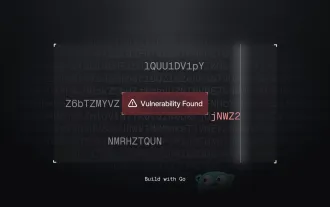 Building a Network Vulnerability Scanner with Go
Apr 01, 2025 am 08:27 AM
Building a Network Vulnerability Scanner with Go
Apr 01, 2025 am 08:27 AM
This Go-based network vulnerability scanner efficiently identifies potential security weaknesses. It leverages Go's concurrency features for speed and includes service detection and vulnerability matching. Let's explore its capabilities and ethical
 Prompt Engineering for Web Development
Mar 09, 2025 am 08:27 AM
Prompt Engineering for Web Development
Mar 09, 2025 am 08:27 AM
AI Prompt Engineering for Code Generation: A Developer's Guide The landscape of code development is poised for a significant shift. Mastering Large Language Models (LLMs) and prompt engineering will be crucial for developers in the coming years. Th
