This article brings you a detailed introduction to the mysql function for geographical location geo processing (with code). It has certain reference value. Friends in need can refer to it. I hope it will be helpful to you.
Currently, more and more businesses are based on LBS, nearby people, takeout locations, nearby businesses, etc. Now we will discuss the solution for the business scenario closest to me.
Currently known solutions are:
mysql custom function calculation mysql geo index mongodb geo index postgresql PostGis index redis geoElasticSearchThis article tests the performance of mysql function operation
Preparation Work
Create data table
CREATE TABLE `driver` (
  `id` int(11) unsigned NOT NULL AUTO_INCREMENT,
  `lng` float DEFAULT NULL,
  `lat` float DEFAULT NULL,
  PRIMARY KEY (`id`)
) ENGINE=InnoDB DEFAULT CHARSET=utf8;
Understand basic geographical knowledge before creating data:
In the case of equal latitude:
In the case of equal longitude:
DELIMITER //
CREATE DEFINER=`root`@`localhost` FUNCTION `getDistance`(
    `lng1` float(10,7)
    ,
    `lat1` float(10,7)
    ,
    `lng2` float(10,7)
    ,
    `lat2` float(10,7)

) RETURNS double
    COMMENT '计算2坐标点距离'
BEGIN
    declare d double;
    declare radius int;
    set radius = 6371000; #假设地球为正球形,直径为6371000米
    set d = (2*ATAN2(SQRT(SIN((lat1-lat2)*PI()/180/2)
        *SIN((lat1-lat2)*PI()/180/2)+
        COS(lat2*PI()/180)*COS(lat1*PI()/180)
        *SIN((lng1-lng2)*PI()/180/2)
        *SIN((lng1-lng2)*PI()/180/2)),
        SQRT(1-SIN((lat1-lat2)*PI()/180/2)
        *SIN((lat1-lat2)*PI()/180/2)
        +COS(lat2*PI()/180)*COS(lat1*PI()/180)
        *SIN((lng1-lng2)*PI()/180/2)
        *SIN((lng1-lng2)*PI()/180/2))))*radius;
    return d;
END//
DELIMITER ;
# coding=utf-8
from orator import DatabaseManager, Model
import logging
import random
import threading

""" 中国的经纬度范围 纬度3.86~53.55,经度73.66~135.05。大概0.00001度差距1米 """

# 创建 日志 对象
logger = logging.getLogger()
handler = logging.StreamHandler()
formatter = logging.Formatter(
    '%(asctime)s %(name)-12s %(levelname)-8s %(message)s')
handler.setFormatter(formatter)
logger.addHandler(handler)
logger.setLevel(logging.DEBUG)

# Connect to the database

config = {
    'mysql': {
        'driver': 'mysql',
        'host': 'localhost',
        'database': 'dbtest',
        'user': 'root',
        'password': '',
        'prefix': ''
    }
}

db = DatabaseManager(config)
Model.set_connection_resolver(db)


class Driver(Model):
    __table__ = 'driver'
    __timestamps__ = False
    pass


def ins_driver(thread_name,nums):
    logger.info('开启线程%s' % thread_name)
    for _ in range(nums):
        lng = '%.5f' % random.uniform(73.66, 135.05)
        lat = '%.5f' % random.uniform(3.86, 53.55)

        driver = Driver()
        driver.lng = lng
        driver.lat = lat
        driver.save()

thread_nums = 10
for i in range(thread_nums):
    t = threading.Thread(target=ins_driver, args=(i, 400000))
    t.start()
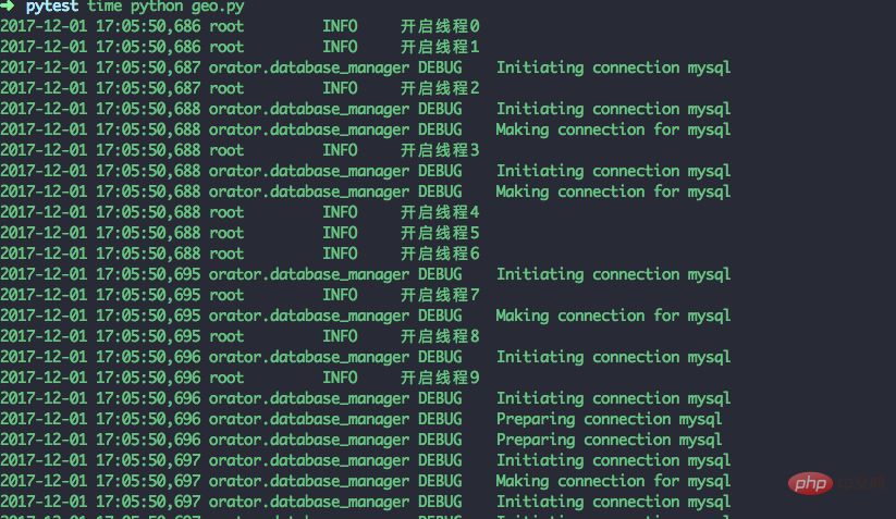
The above script creates 10 threads, and 10 threads insert 40,000 pieces of data. It took 150.18s to execute, and a total of 400,000 pieces of data were inserted
System: mac os
Memory :16G
cpu: intel core i5
Hard disk: 500g solid state drive
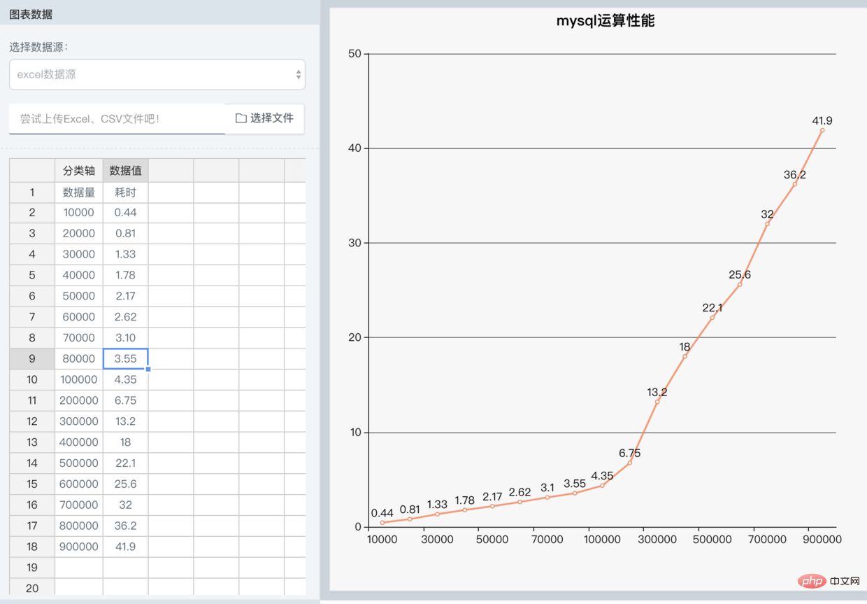
Under the test, find the 10 closest drivers to the coordinate point (134.38753, 18.56734)
select *,`getDistance`(134.38753,18.56734,`lng`,`lat`) as dis from driver ORDER BY dis limit 10
I tested from 10,000 to 100,000 at intervals of 10,000 and from 100,000 to 90 Changes in results every 100,000 tests

The above is the detailed content of Detailed introduction of mysql function for geographical location geo processing (with code). For more information, please follow other related articles on the PHP Chinese website!