

How to mark on Google Maps


You can mark it on Google Maps through text attribute editing.
1. Open the Google Map downloader, click "My Markup" → "Switch Map" → "Satellite Map" → "Satellite.Google Map" to switch the map that needs to be marked to Google Maps.

Related recommendations: "FAQ"
2. Click the "click" button above the software. Left-clicking the marked place will pop up the "Point Attribute Edit" dialog box. You can set the name, coordinates, label, font, font size, font color, remarks and other attributes of the point in the dialog box. There are also other attributes on the right side of the dialog box. You can select the style of the icon for labeling points and click "OK" to complete the labeling.


3. Click the "Line" button at the top of the software, and then start drawing a line on the map. After drawing, right-click to end the drawing. The line will pop up the "Discount Attribute Edit" dialog box, in which the name, color, edge width and other properties of the polyline can be set.

#4. If you need to display the name of the polyline on the map, you can click the "Text" button and mark the text, and click "OK" to complete the text marking.


5. If you need to mark on other maps, the method is the same, just switch the map.
The above is the detailed content of How to mark on Google Maps. For more information, please follow other related articles on the PHP Chinese website!

Hot AI Tools

Undresser.AI Undress
AI-powered app for creating realistic nude photos

AI Clothes Remover
Online AI tool for removing clothes from photos.

Undress AI Tool
Undress images for free

Clothoff.io
AI clothes remover

AI Hentai Generator
Generate AI Hentai for free.

Hot Article
Hot Tools

Notepad++7.3.1
Easy-to-use and free code editor

SublimeText3 Chinese version
Chinese version, very easy to use

Zend Studio 13.0.1
Powerful PHP integrated development environment

Dreamweaver CS6
Visual web development tools

SublimeText3 Mac version
God-level code editing software (SublimeText3)
Hot Topics
 1376
1376
 52
52

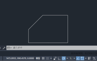 How to set manual input dimensions for CAD annotation
Feb 27, 2024 pm 07:50 PM
How to set manual input dimensions for CAD annotation
Feb 27, 2024 pm 07:50 PM
CAD software is widely used in various design fields, and dimensioning is an indispensable part of CAD design. Sometimes, designers need to manually enter dimensions to ensure accuracy and flexibility. So this article will introduce in detail how to manually set and input dimensions in CAD. Users who don’t know how to set up manual input dimensions should come and learn along with this article! Steps for manually inputting size settings for CAD annotations: 1. Open the CAD2023 software, create a new blank document, and create a drawing, as shown below: 2. Then click the linear tool to create a linear annotation. As shown below: 3. Then click on both ends of the straight line to mark. As shown below: 4. Then enter T, or click the text (T) below, as shown below: 5. Hand
 Will the autonomous driving annotation industry be subverted by the world model in 2024?
Mar 01, 2024 pm 10:37 PM
Will the autonomous driving annotation industry be subverted by the world model in 2024?
Mar 01, 2024 pm 10:37 PM
1. Problems faced by data annotation (especially based on BEV tasks) With the rise of BEV transformer-based tasks, the dependence on data has become heavier and heavier, and the annotation based on BEV tasks has also become more and more complex. important. At present, whether it is 2D-3D joint obstacle annotation, lane line annotation based on reconstructed point cloud clips or Occpuancy task annotation, it is still too expensive (compared with 2D annotation tasks, it is much more expensive). Of course, there are also many semi-automatic or automated annotation studies based on large models in the industry. On the other hand, the data collection cycle for autonomous driving is too long and involves a series of data compliance issues. For example, you want to capture the field of a flatbed truck across the camera.
 Instructions for using Google Maps offline map
Mar 19, 2024 pm 01:10 PM
Instructions for using Google Maps offline map
Mar 19, 2024 pm 01:10 PM
How to use Google Maps offline map? The Google Maps APP is very rich in functions. For example, it supports offline map functions and can also use map services offline. The following editor brings you a guide for using Google Maps offline maps. Please take a look. 1. Click your avatar in the upper right corner of the page 2. Select the [Offline Map] function on the personal account page 3. Select your own map. You need to download the map in advance before you can use the offline map function 4. After finding the map, click Download and wait for the map download to complete 5. Finally, you can see the downloaded map in the list of offline map pages, click to use it
 How to set up 3D map in Google Maps mobile version
Apr 01, 2024 pm 04:26 PM
How to set up 3D map in Google Maps mobile version
Apr 01, 2024 pm 04:26 PM
The 3D mode of Google Maps is favored by users because it can present map information in a more three-dimensional way, allowing users to clearly view their location. Therefore, the editor of this article has prepared a method to enable the 3D map mode of the mobile version of Google Maps. Let’s learn together. . How to turn on the 3D map mode of Google Maps mobile version 1. First, enter the location you want to view at any time in the input box above. 2. After finding the location, click the small icon of the location shown in the picture below. 3. Then click [3D] in the function menu. Option 4. After selecting the 3D function to turn on, click on the location you want to view. You can see a small window in the lower left corner. Click on the window to enlarge. 5. Finally, we can see the 3D real-time street view.
 How to mark Amap on Amap_Amap mark tutorial
Apr 01, 2024 pm 01:51 PM
How to mark Amap on Amap_Amap mark tutorial
Apr 01, 2024 pm 01:51 PM
1. First enter the Amap and click on More Tools options. 2. Then click the feedback reporting option. 3. Then click on the Add Road option. 4. Finally, enter the road information and upload the picture.
 How to perform semi-supervised learning and annotation in PHP?
May 22, 2023 pm 12:10 PM
How to perform semi-supervised learning and annotation in PHP?
May 22, 2023 pm 12:10 PM
In the field of machine learning, supervised learning is a common model training method, but it requires a large amount of labeled data for training. However, for some scenarios where it is difficult to obtain a large amount of annotated data, such as spam filtering, social network analysis, etc., semi-supervised learning has become an effective solution. As a popular web development language, PHP also has many practical tools and techniques for applying semi-supervised learning and annotation. 1. Semi-supervised learning Semi-supervised learning is a learning method between unsupervised learning and supervised learning. It uses a small number of
 How to delete Google Maps history
Apr 01, 2024 pm 06:43 PM
How to delete Google Maps history
Apr 01, 2024 pm 06:43 PM
Google Maps is a powerful and easy-to-use map service application that accurately locates users' locations and provides detailed navigation route planning to help users easily find their destinations. Google Maps Google Maps Clear History Steps and Processes 1. Open the Google Maps APP and click on the personal avatar next to the search box; 2. Find the [Settings] option on the account information page. 3. Find [Map History] in the settings list. 4. You can see the delete button on the history page, select the record you want to delete, and finally confirm the deletion.
 Efficiency increased by 16 times! VRSO: 3D annotation of purely visual static objects, opening up the data closed loop!
Apr 11, 2024 pm 04:16 PM
Efficiency increased by 16 times! VRSO: 3D annotation of purely visual static objects, opening up the data closed loop!
Apr 11, 2024 pm 04:16 PM
Annotation of static object detection (SOD), including traffic lights, guide signs and traffic cones, most algorithms are data-driven deep neural networks and require a large amount of training data. Current practice typically involves manual annotation of a large number of training samples on LiDAR-scanned point cloud data to fix long-tail cases. Manual annotation has difficulty capturing the variability and complexity of real scenes and often fails to account for occlusions, different lighting conditions, and diverse viewing angles (yellow arrows in Figure 1). The entire process has long links, is extremely time-consuming, error-prone, and costly (Figure 2). Therefore, companies are currently looking for automatic labeling solutions, especially based on pure vision. After all, not every car has lidar. VRSO+ is a visual-based labeling oriented for static object labeling.