
 Operation and Maintenance
Nginx
How nginx implements load balancing of multiple geoserver services
Operation and Maintenance
Nginx
How nginx implements load balancing of multiple geoserver services
How nginx implements load balancing of multiple geoserver services

Overview
In order to improve the access speed of the service, reduce the pressure on the geoserver service, and avoid problems with service nodes that affect the stability of service access, we usually solve the problem by deploying multiple geoservers, but deploying After installing multiple geoservers, we need a unified interface for use. nginx can meet such needs very well. This article talks about how to achieve load balancing of multiple geoserver services through nginx.
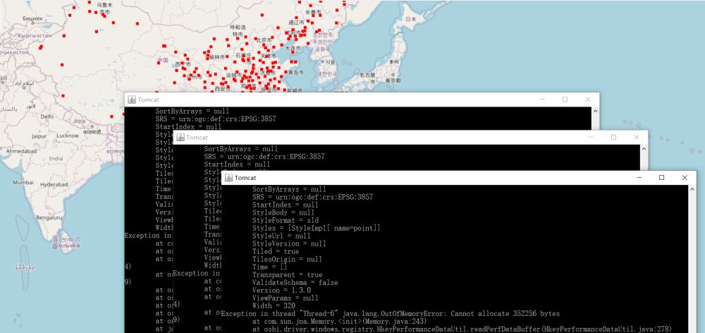
Implementation effect
Implementation
1. Multiple geoserver deployment
In order to keep the geoserver service consistent, we first Configure a geoserver service. After configuring, copy the deployed Tomcat and clone multiple ones. This article copied two (three geoservers in total) for demonstration. Modify the Tomcat port so that the three ports do not conflict. After copying, respectively Start three Tomcats.
2. nginx configuration
Modify the nginx.conf file, the configuration information is as follows:
#user  nobody;
worker_processes  1;

#error_log  logs/error.log;
#error_log  logs/error.log  notice;
#error_log  logs/error.log  info;

#pid        logs/nginx.pid;


events {
    worker_connections  1024;
}


http {
    include       mime.types;
    default_type  application/octet-stream;

    #log_format  main  '$remote_addr - $remote_user [$time_local] "$request" '
    #                  '$status $body_bytes_sent "$http_referer" '
    #                  '"$http_user_agent" "$http_x_forwarded_for"';

    #access_log  logs/access.log  main;

    sendfile        on;
    #tcp_nopush     on;

    #keepalive_timeout  0;
    keepalive_timeout  65;

    #gzip  on;

    # 反向代理配置
    upstream server_list{
       # 这个是tomcat的访问路径
       server localhost:8081;
       server localhost:8082;
       server localhost:8083;
    }
    server {
        listen       80;
        server_name  localhost;

        location / {
            add_header 'Access-Control-Allow-Origin' $http_origin;
            add_header 'Access-Control-Allow-Credentials' 'true';
            add_header 'Access-Control-Allow-Methods' 'GET, POST, OPTIONS';
            add_header 'Access-Control-Allow-Headers' 'DNT,web-token,app-token,Authorization,Accept,Origin,Keep-Alive,User-Agent,X-Mx-ReqToken,X-Data-Type,X-Auth-Token,X-Requested-With,If-Modified-Since,Cache-Control,Content-Type,Range';
            add_header 'Access-Control-Expose-Headers' 'Content-Length,Content-Range';
            if ($request_method = 'OPTIONS') {
                add_header 'Access-Control-Max-Age' 1728000;
                add_header 'Content-Type' 'text/plain; charset=utf-8';
                add_header 'Content-Length' 0;
                return 204;
            }
            root   html;
            proxy_pass http://server_list;
            index  index.html index.htm;
        }

        error_page   500 502 503 504  /50x.html;
        location = /50x.html {
            root   html;
        }
    }
}After configuring nginx, start nginx.
3. Front-end call
According to the above configuration, the port of nginx is 80, so the address of geoserver is http://localhost/geoserver. The calling code in ol is as follows:
<!doctype html>
<html lang="en">
<head>
<meta charset="UTF-8">
<title>OpenLayers map preview</title>
<link rel="stylesheet" href="lib/ol/ol.css" rel="external nofollow" type="text/css">
<link rel="stylesheet" href="css/common.css" rel="external nofollow" >
<script src="../ol5/ol.js" type="text/javascript"></script>
</head>
<body>
<div id="map" class="map"></div>
<script>
const options = {
center: [52102781.07568731, 4456849.777083951],
zoom: 3,
minZoom: 0,
maxZoom: 18
}
const base = new ol.layer.Tile({
visible: true,
source: new ol.source.OSM()
});
const wms = new ol.layer.Tile({
source: new ol.source.TileWMS({
url: 'http://localhost/geoserver/mapbox/wms',
params: {'LAYERS': 'mapbox:city', 'TILED': true},
serverType: 'geoserver',
transition: 0
})
})
window.map = new ol.Map({
controls: ol.control.defaults({
attribution: false
}).extend([new ol.control.ScaleLine()]),
target: 'map',
layers: [base, wms],
view: new ol.View({
center: options.center,
zoom: options.zoom,
minZoom: options.minZoom,
maxZoom: options.maxZoom
})
});
</script>
</body>
</html>The above is the detailed content of How nginx implements load balancing of multiple geoserver services. For more information, please follow other related articles on the PHP Chinese website!

Hot AI Tools

Undresser.AI Undress
AI-powered app for creating realistic nude photos

AI Clothes Remover
Online AI tool for removing clothes from photos.

Undress AI Tool
Undress images for free

Clothoff.io
AI clothes remover

AI Hentai Generator
Generate AI Hentai for free.

Hot Article
Hot Tools

Notepad++7.3.1
Easy-to-use and free code editor

SublimeText3 Chinese version
Chinese version, very easy to use

Zend Studio 13.0.1
Powerful PHP integrated development environment

Dreamweaver CS6
Visual web development tools

SublimeText3 Mac version
God-level code editing software (SublimeText3)
Hot Topics


 How to allow external network access to tomcat server
Apr 21, 2024 am 07:22 AM
How to allow external network access to tomcat server
Apr 21, 2024 am 07:22 AM
To allow the Tomcat server to access the external network, you need to: modify the Tomcat configuration file to allow external connections. Add a firewall rule to allow access to the Tomcat server port. Create a DNS record pointing the domain name to the Tomcat server public IP. Optional: Use a reverse proxy to improve security and performance. Optional: Set up HTTPS for increased security.
 How to run thinkphp
Apr 09, 2024 pm 05:39 PM
How to run thinkphp
Apr 09, 2024 pm 05:39 PM
Steps to run ThinkPHP Framework locally: Download and unzip ThinkPHP Framework to a local directory. Create a virtual host (optional) pointing to the ThinkPHP root directory. Configure database connection parameters. Start the web server. Initialize the ThinkPHP application. Access the ThinkPHP application URL and run it.
 What are the nginx start and stop commands?
Apr 02, 2024 pm 08:45 PM
What are the nginx start and stop commands?
Apr 02, 2024 pm 08:45 PM
The start and stop commands of Nginx are nginx and nginx -s quit respectively. The start command starts the server directly, while the stop command gracefully shuts down the server, allowing all current requests to be processed. Other available stop signals include stop and reload.
 Welcome to nginx!How to solve it?
Apr 17, 2024 am 05:12 AM
Welcome to nginx!How to solve it?
Apr 17, 2024 am 05:12 AM
To solve the "Welcome to nginx!" error, you need to check the virtual host configuration, enable the virtual host, reload Nginx, if the virtual host configuration file cannot be found, create a default page and reload Nginx, then the error message will disappear and the website will be normal show.
 How to deploy nodejs project to server
Apr 21, 2024 am 04:40 AM
How to deploy nodejs project to server
Apr 21, 2024 am 04:40 AM
Server deployment steps for a Node.js project: Prepare the deployment environment: obtain server access, install Node.js, set up a Git repository. Build the application: Use npm run build to generate deployable code and dependencies. Upload code to the server: via Git or File Transfer Protocol. Install dependencies: SSH into the server and use npm install to install application dependencies. Start the application: Use a command such as node index.js to start the application, or use a process manager such as pm2. Configure a reverse proxy (optional): Use a reverse proxy such as Nginx or Apache to route traffic to your application
 How to register phpmyadmin
Apr 07, 2024 pm 02:45 PM
How to register phpmyadmin
Apr 07, 2024 pm 02:45 PM
To register for phpMyAdmin, you need to first create a MySQL user and grant permissions to it, then download, install and configure phpMyAdmin, and finally log in to phpMyAdmin to manage the database.
 How to solve the problem of nginx when accessing the website
Apr 02, 2024 pm 08:39 PM
How to solve the problem of nginx when accessing the website
Apr 02, 2024 pm 08:39 PM
nginx appears when accessing a website. The reasons may be: server maintenance, busy server, browser cache, DNS issues, firewall blocking, website misconfiguration, network connection issues, or the website is down. Try the following solutions: wait for maintenance to end, visit during off-peak hours, clear your browser cache, flush your DNS cache, disable firewall or antivirus software, contact the site administrator, check your network connection, or use a search engine or web archive to find another copy of the site. If the problem persists, please contact the site administrator.
 How to communicate between docker containers
Apr 07, 2024 pm 06:24 PM
How to communicate between docker containers
Apr 07, 2024 pm 06:24 PM
There are five methods for container communication in the Docker environment: shared network, Docker Compose, network proxy, shared volume, and message queue. Depending on your isolation and security needs, choose the most appropriate communication method, such as leveraging Docker Compose to simplify connections or using a network proxy to increase isolation.
