

Scene recognition problems in UAV image processing


Scene recognition problems in drone image processing require specific code examples
The rapid development of drone technology has made it more and more widely used in various fields. Widely, one of them is image processing. The drone is equipped with a high-definition camera that can take real-time shots and videos of the surrounding environment. However, how to perform scene recognition for UAV images is still a challenging problem. This article will introduce the scene recognition problem in UAV image processing in detail and give some specific code examples.
Scene recognition refers to matching input images with known scenes to determine the current environment. It is very important for drones to accurately identify the scene they are currently in, because they can make appropriate decisions based on scene information. For example, in the field of agriculture, drones can determine the growth of crops and perform related operations based on different scenarios; in the field of search and rescue, drones can determine whether there are trapped people based on different scenarios.
In order to achieve scene recognition in drone image processing, we can use deep learning technology in the field of computer vision. Specifically, we can use Convolutional Neural Network (CNN) for image classification tasks. Through multi-layer convolution and pooling operations, CNN can extract high-level features from the input image and compare it with known scenes to obtain the final classification result.
The following is a simple scene recognition code example based on the TensorFlow framework:
import tensorflow as tf
from tensorflow.keras import layers

# 加载数据集(可以根据实际情况进行修改)
(train_images, train_labels), (test_images, test_labels) = tf.keras.datasets.cifar10.load_data()
train_labels = tf.keras.utils.to_categorical(train_labels, num_classes=10)
test_labels = tf.keras.utils.to_categorical(test_labels, num_classes=10)

# 构建模型
model = tf.keras.Sequential([
    layers.Conv2D(32, (3, 3), activation='relu', input_shape=(32, 32, 3)),
    layers.MaxPooling2D((2, 2)),
    layers.Conv2D(64, (3, 3), activation='relu'),
    layers.MaxPooling2D((2, 2)),
    layers.Conv2D(64, (3, 3), activation='relu'),
    layers.Flatten(),
    layers.Dense(64, activation='relu'),
    layers.Dense(10, activation='softmax')
])

# 编译模型
model.compile(optimizer='adam',
              loss=tf.keras.losses.CategoricalCrossentropy(from_logits=True),
              metrics=['accuracy'])

# 训练模型
model.fit(train_images, train_labels, epochs=10, validation_data=(test_images, test_labels))

# 使用模型进行预测
predictions = model.predict(test_images)The above code first loads the CIFAR-10 data set, which is a commonly used image classification data set, including 10 different scene categories. We then built a simple CNN model and used the Adam optimizer and cross-entropy loss function for model compilation. Next, use the training set to train the model. After training is completed, we can use the test set to predict the model.
It should be noted that the above code is just a simple example, and the actual scene recognition problem may be more complex. Therefore, according to actual needs, we can adjust and optimize the model, add more convolutional layers or fully connected layers, and even use pre-trained models for transfer learning.
To sum up, the scene recognition problem in UAV image processing is a challenging task. Through deep learning technology and appropriate data sets, we can achieve scene recognition on drone images. Through the above code examples, readers can have a preliminary understanding of the basic process of scene recognition in UAV image processing, and make corresponding modifications and optimizations according to actual needs.
The above is the detailed content of Scene recognition problems in UAV image processing. For more information, please follow other related articles on the PHP Chinese website!

Hot AI Tools

Undresser.AI Undress
AI-powered app for creating realistic nude photos

AI Clothes Remover
Online AI tool for removing clothes from photos.

Undress AI Tool
Undress images for free

Clothoff.io
AI clothes remover

Video Face Swap
Swap faces in any video effortlessly with our completely free AI face swap tool!

Hot Article
Hot Tools

Notepad++7.3.1
Easy-to-use and free code editor

SublimeText3 Chinese version
Chinese version, very easy to use

Zend Studio 13.0.1
Powerful PHP integrated development environment

Dreamweaver CS6
Visual web development tools

SublimeText3 Mac version
God-level code editing software (SublimeText3)
Hot Topics
 1386
1386
 52
52

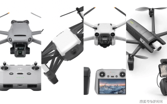 2024 DJI drone rankings: Each model has sales of 50,000+, which one have you used?
Dec 16, 2023 pm 05:33 PM
2024 DJI drone rankings: Each model has sales of 50,000+, which one have you used?
Dec 16, 2023 pm 05:33 PM
Hello, hello! I am Yuan Haha, please pay attention, more exciting content is waiting for you. With the continuous advancement of drone technology, we can now buy one of the most important and reliable 4K cameras within a budget of several thousand yuan. This is how many times Unimaginable years ago. With the continuous efforts of DJI, Autel and other companies, this dream has become a reality. The overall drone of choice is DJI Mavic 3 Pro. This drone not only provides ultra-high definition recording, but also has excellent frame rates and long-lasting battery. life. In addition to my personal experience, I’ve compiled some other top drones for you to choose from based on positive reviews around the web. Now, let’s take a look at these exciting options. Best Drone Overall: DJIMavic 3Pr
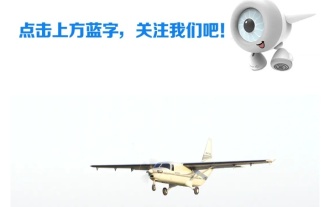 The largest domestically produced unmanned transport aircraft successfully made its maiden flight: equipped with China Aviation Engineering Group's AEP100-A engine
Aug 23, 2024 am 07:32 AM
The largest domestically produced unmanned transport aircraft successfully made its maiden flight: equipped with China Aviation Engineering Group's AEP100-A engine
Aug 23, 2024 am 07:32 AM
According to news from this website on August 22, China Aviation Engine Group Co., Ltd. issued an official announcement today. At 6:28 today, the 900-kilowatt turboprop engine AEP100-A, which was completely independently developed by China Aviation Industry Corporation, powered the SA750U large unmanned transport aircraft in Shaanxi. Successful first flight. According to reports, the AEP100-A turboprop engine was designed by the China Aerospace Engineering Research Institute and manufactured in the South. It has the ability to adapt to high temperatures and plateaus. It uses three-dimensional aerodynamic design and unit design technology to provide power for aircraft while improving fuel economy. Improve overall aircraft operating efficiency. The AEP100 turboprop engine series can be equipped with 2 to 6 ton general-purpose aircraft or 3 to 10 ton unmanned aerial vehicles, and its comprehensive performance has reached the international advanced level of the same level currently in service. This site reported earlier
 How is Wasserstein distance used in image processing tasks?
Jan 23, 2024 am 10:39 AM
How is Wasserstein distance used in image processing tasks?
Jan 23, 2024 am 10:39 AM
Wasserstein distance, also known as EarthMover's Distance (EMD), is a metric used to measure the difference between two probability distributions. Compared with traditional KL divergence or JS divergence, Wasserstein distance takes into account the structural information between distributions and therefore exhibits better performance in many image processing tasks. By calculating the minimum transportation cost between two distributions, Wasserstein distance is able to measure the minimum amount of work required to transform one distribution into another. This metric is able to capture the geometric differences between distributions, thereby playing an important role in tasks such as image generation and style transfer. Therefore, the Wasserstein distance becomes the concept
 In-depth analysis of the working principles and characteristics of the Vision Transformer (VIT) model
Jan 23, 2024 am 08:30 AM
In-depth analysis of the working principles and characteristics of the Vision Transformer (VIT) model
Jan 23, 2024 am 08:30 AM
VisionTransformer (VIT) is a Transformer-based image classification model proposed by Google. Different from traditional CNN models, VIT represents images as sequences and learns the image structure by predicting the class label of the image. To achieve this, VIT divides the input image into multiple patches and concatenates the pixels in each patch through channels and then performs linear projection to achieve the desired input dimensions. Finally, each patch is flattened into a single vector, forming the input sequence. Through Transformer's self-attention mechanism, VIT is able to capture the relationship between different patches and perform effective feature extraction and classification prediction. This serialized image representation is
 Application of AI technology in image super-resolution reconstruction
Jan 23, 2024 am 08:06 AM
Application of AI technology in image super-resolution reconstruction
Jan 23, 2024 am 08:06 AM
Super-resolution image reconstruction is the process of generating high-resolution images from low-resolution images using deep learning techniques, such as convolutional neural networks (CNN) and generative adversarial networks (GAN). The goal of this method is to improve the quality and detail of images by converting low-resolution images into high-resolution images. This technology has wide applications in many fields, such as medical imaging, surveillance cameras, satellite images, etc. Through super-resolution image reconstruction, we can obtain clearer and more detailed images, which helps to more accurately analyze and identify targets and features in images. Reconstruction methods Super-resolution image reconstruction methods can generally be divided into two categories: interpolation-based methods and deep learning-based methods. 1) Interpolation-based method Super-resolution image reconstruction based on interpolation
 How to use AI technology to restore old photos (with examples and code analysis)
Jan 24, 2024 pm 09:57 PM
How to use AI technology to restore old photos (with examples and code analysis)
Jan 24, 2024 pm 09:57 PM
Old photo restoration is a method of using artificial intelligence technology to repair, enhance and improve old photos. Using computer vision and machine learning algorithms, the technology can automatically identify and repair damage and flaws in old photos, making them look clearer, more natural and more realistic. The technical principles of old photo restoration mainly include the following aspects: 1. Image denoising and enhancement. When restoring old photos, they need to be denoised and enhanced first. Image processing algorithms and filters, such as mean filtering, Gaussian filtering, bilateral filtering, etc., can be used to solve noise and color spots problems, thereby improving the quality of photos. 2. Image restoration and repair In old photos, there may be some defects and damage, such as scratches, cracks, fading, etc. These problems can be solved by image restoration and repair algorithms
 Scale Invariant Features (SIFT) algorithm
Jan 22, 2024 pm 05:09 PM
Scale Invariant Features (SIFT) algorithm
Jan 22, 2024 pm 05:09 PM
The Scale Invariant Feature Transform (SIFT) algorithm is a feature extraction algorithm used in the fields of image processing and computer vision. This algorithm was proposed in 1999 to improve object recognition and matching performance in computer vision systems. The SIFT algorithm is robust and accurate and is widely used in image recognition, three-dimensional reconstruction, target detection, video tracking and other fields. It achieves scale invariance by detecting key points in multiple scale spaces and extracting local feature descriptors around the key points. The main steps of the SIFT algorithm include scale space construction, key point detection, key point positioning, direction assignment and feature descriptor generation. Through these steps, the SIFT algorithm can extract robust and unique features, thereby achieving efficient image processing.
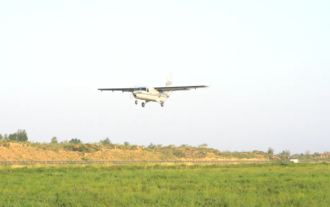 my country's first large-scale unmanned transport aircraft with a load exceeding 3 tons, the 'SA750U', successfully made its maiden flight, with nationally produced systems and materials
Aug 23, 2024 am 07:31 AM
my country's first large-scale unmanned transport aircraft with a load exceeding 3 tons, the 'SA750U', successfully made its maiden flight, with nationally produced systems and materials
Aug 23, 2024 am 07:31 AM
According to news from this site on August 22, according to the official public account of "Shanhe Huayu", at 6:28 today, the SA750U large unmanned transport aircraft independently developed by Sunward Huayu Aviation Technology and completed by the strategic coordination of Sunward Star Airlines flew from Jingbian, Xi'an. The experimental drone test center successfully made its first flight. ▲Picture source "Shanhe Huayu" official public account, the same as below. According to reports, during the 40-minute flight test, all system equipment of the aircraft worked normally and were in good condition. The attitude of the aircraft was stable and the performance met the design specifications. After completing the scheduled flight subjects Afterwards, the plane returned smoothly and the first flight was a complete success. The SA750U is my country's first large-scale unmanned transport aircraft with a load of over 3 tons. It only took Shanhe Huayu Company 2 years and 8 months to complete the entire process from concept design to the successful first flight of the first aircraft.
