
 Web Front-end
JS Tutorial
Using JavaScript and Tencent Maps to implement map rectangular editing function
Web Front-end
JS Tutorial
Using JavaScript and Tencent Maps to implement map rectangular editing function
Using JavaScript and Tencent Maps to implement map rectangular editing function

With the development of Internet technology, Web maps have become an important tool for data display and interaction. In Web maps, one of the common functions is map rectangle editing. Users can select areas of interest by dragging rectangles on the map. This article will introduce how to use JavaScript and Tencent Maps to implement the map rectangle editing function, and provide specific code examples.
1. Prerequisites
Before we start writing code, we need to prepare the following conditions:
- A valid Tencent Maps developer account;
- Introduction of Tencent Maps JavaScript API;
- Installation and configuration of editors (such as Visual Studio Code).
2. Create a map and add a toolbar
Create a container in the HTML file to display the map. Then write some JavaScript code, create the map, and add a toolbar.
<!DOCTYPE html>
<html>
<head>
    <meta charset="utf-8">
    <title>地图矩形编辑示例</title>
    <style type="text/css">
        #map-container {
            width: 100%;
            height: 600px;
        }
    </style>
</head>
<body>
    <div id="map-container"></div>
    <script type="text/javascript" src="https://map.qq.com/api/js?v=2.exp&key=YOUR_KEY_HERE"></script>
    <script type="text/javascript">
        var map = new qq.maps.Map(document.getElementById('map-container'), {
            center: new qq.maps.LatLng(39.916527, 116.397128),
            zoom: 10
        });

        //添加矩形工具栏
        var toolBar = new qq.maps.DrawingTools({
            map: map,
            drawingMode: qq.maps.DrawingTool.RECTANGLE,
            rectangleOptions: {
                fillColor: qq.maps.Color.fromHex('#FF6600', 0.4),
                strokeColor: qq.maps.Color.fromHex('#FF6600'),
                strokeWidth: 2
            }
        });
    </script>
</body>
</html>Code explanation:
- First create a map container to render the map onto the page;
- Introduce the JavaScript API of Tencent Maps;
- Create a map instance, and set the map center point and zoom level;
- Create a toolbar, specify the drawing mode as rectangle, and set the rectangle style.
3. Capture the rectangle drawing event
Now, we have successfully added a rectangular toolbar. However, what we need to do is capture the event when the user draws a rectangle and output the rectangle's border coordinates on the console.
<!DOCTYPE html>
<html>
<head>
    <meta charset="utf-8">
    <title>地图矩形编辑示例</title>
    <style type="text/css">
        #map-container {
            width: 100%;
            height: 600px;
        }
    </style>
</head>
<body>
    <div id="map-container"></div>
    <script type="text/javascript" src="https://map.qq.com/api/js?v=2.exp&key=YOUR_KEY_HERE"></script>
    <script type="text/javascript">
        var map = new qq.maps.Map(document.getElementById('map-container'), {
            center: new qq.maps.LatLng(39.916527, 116.397128),
            zoom: 10
        });

        //添加矩形工具栏
        var toolBar = new qq.maps.DrawingTools({
            map: map,
            drawingMode: qq.maps.DrawingTool.RECTANGLE,
            rectangleOptions: {
                fillColor: qq.maps.Color.fromHex('#FF6600', 0.4),
                strokeColor: qq.maps.Color.fromHex('#FF6600'),
                strokeWidth: 2
            }
        });

        //捕获矩形绘制事件
        qq.maps.event.addListener(toolBar, 'rectanglecomplete', function(event) {
            var bounds = event.getBounds();
            console.log('矩形边框左上角坐标:' + bounds.getNorthEast().toString() + '
矩形边框右下角坐标:' + bounds.getSouthWest().toString());
        });
    </script>
</body>
</html>Code explanation:
- We use the
qq.maps.event.addListener()function to capture the rectangle drawing event; - will The drawn rectangle object is passed to the event listener;
- Get the border coordinates of the rectangle through the rectangle object;
- Output the border coordinates to the console.
4. Draw a rectangle
The last step is to draw a rectangle on the map. We need to create a function that passes the bounding box coordinates of the rectangle as a parameter. In this function, we can use the qq.maps.Polygon class to create a polygon and add it to the map.
<!DOCTYPE html>
<html>
<head>
    <meta charset="utf-8">
    <title>地图矩形编辑示例</title>
    <style type="text/css">
        #map-container {
            width: 100%;
            height: 600px;
        }
    </style>
</head>
<body>
    <div id="map-container"></div>
    <script type="text/javascript" src="https://map.qq.com/api/js?v=2.exp&key=YOUR_KEY_HERE"></script>
    <script type="text/javascript">
        var map = new qq.maps.Map(document.getElementById('map-container'), {
            center: new qq.maps.LatLng(39.916527, 116.397128),
            zoom: 10
        });

        var polygons = [];

        //添加矩形工具栏
        var toolBar = new qq.maps.DrawingTools({
            map: map,
            drawingMode: qq.maps.DrawingTool.RECTANGLE,
            rectangleOptions: {
                fillColor: qq.maps.Color.fromHex('#FF6600', 0.4),
                strokeColor: qq.maps.Color.fromHex('#FF6600'),
                strokeWidth: 2
            }
        });

        //捕获矩形绘制事件
        qq.maps.event.addListener(toolBar, 'rectanglecomplete', function(event) {
            var bounds = event.getBounds();

            //绘制矩形
            var polygon = new qq.maps.Polygon({
                map: map,
                path: [
                    new qq.maps.LatLng(bounds.getNorthEast().getLat(), bounds.getSouthWest().getLng()),
                    new qq.maps.LatLng(bounds.getNorthEast().getLat(), bounds.getNorthEast().getLng()),
                    new qq.maps.LatLng(bounds.getSouthWest().getLat(), bounds.getNorthEast().getLng()),
                    new qq.maps.LatLng(bounds.getSouthWest().getLat(), bounds.getSouthWest().getLng())
                ],
                fillColor: qq.maps.Color.fromHex('#FF6600', 0.4),
                strokeColor: qq.maps.Color.fromHex('#FF6600'),
                strokeWidth: 2
            });

            polygons.push(polygon);
        });
    </script>
</body>
</html>Code explanation:
- We create multiple polygons on the map, so we need an array to store these polygon objects;
- Capture the rectangle drawing event In the callback function, we use the polygon class to create a polygon object;
- We use the border coordinates of the rectangle to create a polygon object, add it to the map, and store it in the polygon array.
So far, we have successfully implemented the map rectangle editing function. Users can select the area of interest by dragging the rectangle on the map and draw the rectangle on the map. For specific code examples, please see the complete example below:
<!DOCTYPE html>
<html>
<head>
    <meta charset="utf-8">
    <title>地图矩形编辑示例</title>
    <style type="text/css">
        #map-container {
            width: 100%;
            height: 600px;
        }
    </style>
</head>
<body>
    <div id="map-container"></div>

    <script type="text/javascript" src="https://map.qq.com/api/js?v=2.exp&key=YOUR_KEY_HERE"></script>
    <script type="text/javascript">
        var map = new qq.maps.Map(document.getElementById('map-container'), {
            center: new qq.maps.LatLng(39.916527, 116.397128),
            zoom: 10
        });

        var polygons = [];

        //添加矩形工具栏
        var toolBar = new qq.maps.DrawingTools({
            map: map,
            drawingMode: qq.maps.DrawingTool.RECTANGLE,
            rectangleOptions: {
                fillColor: qq.maps.Color.fromHex('#FF6600', 0.4),
                strokeColor: qq.maps.Color.fromHex('#FF6600'),
                strokeWidth: 2
            }
        });

        //捕获矩形绘制事件
        qq.maps.event.addListener(toolBar, 'rectanglecomplete', function(event) {
            var bounds = event.getBounds();

            //绘制矩形
            var polygon = new qq.maps.Polygon({
                map: map,
                path: [
                    new qq.maps.LatLng(bounds.getNorthEast().getLat(), bounds.getSouthWest().getLng()),
                    new qq.maps.LatLng(bounds.getNorthEast().getLat(), bounds.getNorthEast().getLng()),
                    new qq.maps.LatLng(bounds.getSouthWest().getLat(), bounds.getNorthEast().getLng()),
                    new qq.maps.LatLng(bounds.getSouthWest().getLat(), bounds.getSouthWest().getLng())
                ],
                fillColor: qq.maps.Color.fromHex('#FF6600', 0.4),
                strokeColor: qq.maps.Color.fromHex('#FF6600'),
                strokeWidth: 2
            });

            polygons.push(polygon);
        });
    </script>
</body>
</html>The above is the detailed content of Using JavaScript and Tencent Maps to implement map rectangular editing function. For more information, please follow other related articles on the PHP Chinese website!

Hot AI Tools

Undresser.AI Undress
AI-powered app for creating realistic nude photos

AI Clothes Remover
Online AI tool for removing clothes from photos.

Undress AI Tool
Undress images for free

Clothoff.io
AI clothes remover

Video Face Swap
Swap faces in any video effortlessly with our completely free AI face swap tool!

Hot Article
Hot Tools

Notepad++7.3.1
Easy-to-use and free code editor

SublimeText3 Chinese version
Chinese version, very easy to use

Zend Studio 13.0.1
Powerful PHP integrated development environment

Dreamweaver CS6
Visual web development tools

SublimeText3 Mac version
God-level code editing software (SublimeText3)
Hot Topics
 1386
1386
 52
52

 How to view street view maps on Tencent Maps How to view street view maps on Tencent Maps
Mar 13, 2024 am 09:46 AM
How to view street view maps on Tencent Maps How to view street view maps on Tencent Maps
Mar 13, 2024 am 09:46 AM
How to view Street View map on Tencent Maps? Tencent Maps is a map navigation software used by many people. It has several special maps for us to choose from, including 3D maps, satellite maps, hand-drawn maps of scenic spots, etc. The one that is closer to the real scene is the street view map. Street view map allows us to see the surrounding environment of the place we want to find on our mobile phone, and we can see what the destination looks like. So how should you view the Street View map? Below, the editor of this site has compiled the methods for viewing the Street View map for your reference. How to view street view on Tencent Maps 1. First we need to enter the address where we want to view street view, and then there will be a [︿] at the bottom of the interface 2. Then you can see an [Enter Street View] option 3. Then
 How to implement an online speech recognition system using WebSocket and JavaScript
Dec 17, 2023 pm 02:54 PM
How to implement an online speech recognition system using WebSocket and JavaScript
Dec 17, 2023 pm 02:54 PM
How to use WebSocket and JavaScript to implement an online speech recognition system Introduction: With the continuous development of technology, speech recognition technology has become an important part of the field of artificial intelligence. The online speech recognition system based on WebSocket and JavaScript has the characteristics of low latency, real-time and cross-platform, and has become a widely used solution. This article will introduce how to use WebSocket and JavaScript to implement an online speech recognition system.
 WebSocket and JavaScript: key technologies for implementing real-time monitoring systems
Dec 17, 2023 pm 05:30 PM
WebSocket and JavaScript: key technologies for implementing real-time monitoring systems
Dec 17, 2023 pm 05:30 PM
WebSocket and JavaScript: Key technologies for realizing real-time monitoring systems Introduction: With the rapid development of Internet technology, real-time monitoring systems have been widely used in various fields. One of the key technologies to achieve real-time monitoring is the combination of WebSocket and JavaScript. This article will introduce the application of WebSocket and JavaScript in real-time monitoring systems, give code examples, and explain their implementation principles in detail. 1. WebSocket technology
 How to set store location information on Tencent Map APP and teach you how to quickly add it
Feb 13, 2024 am 08:27 AM
How to set store location information on Tencent Map APP and teach you how to quickly add it
Feb 13, 2024 am 08:27 AM
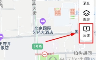
After adding your own store on Tencent Map, others can easily find the location of their store using the software to navigate and navigate directly to the store. So how to set store location information on Tencent Maps? Let me teach you below. [Add method] 1. Open the Tencent Maps app and click [Feedback] in the upper right corner of the homepage. 2. In the feedback page, we select [Merchant Settlement] in the location-related field. 3. Then you are prompted to bind WeChat ID. Please associate QQ with WeChat on Tencent Map so that the Merchant Center can synchronize the merchant entry records of the QQ account and identify your merchant identity. After the accounts are bound, your asset data will be interconnected. 4. Or you can directly select a location to add, but you will not be able to enjoy merchant rights. Merchant rights are officially certified
 How to use JavaScript and WebSocket to implement a real-time online ordering system
Dec 17, 2023 pm 12:09 PM
How to use JavaScript and WebSocket to implement a real-time online ordering system
Dec 17, 2023 pm 12:09 PM
Introduction to how to use JavaScript and WebSocket to implement a real-time online ordering system: With the popularity of the Internet and the advancement of technology, more and more restaurants have begun to provide online ordering services. In order to implement a real-time online ordering system, we can use JavaScript and WebSocket technology. WebSocket is a full-duplex communication protocol based on the TCP protocol, which can realize real-time two-way communication between the client and the server. In the real-time online ordering system, when the user selects dishes and places an order
 How to share location on Tencent Maps How to share location on Tencent Maps
Mar 12, 2024 pm 02:34 PM
How to share location on Tencent Maps How to share location on Tencent Maps
Mar 12, 2024 pm 02:34 PM
How to share location on Tencent Maps? Tencent Maps is a very popular map navigation software. We can find the location we want to remove on it, then choose a trip that suits us based on the travel methods provided by the navigation, and then set off based on the navigation. It can also accurately locate our location in real time. If we are outside, we can also share our location with friends and let them find us. So how do we share our location? Below, the editor of this website has compiled the distribution of shared locations for your reference. How to share your location on Tencent Maps 1. First find your location on the map, which is a small blue dot, usually in the middle of the map 2. After clicking on the small dot, the current location will appear at the bottom of the system 3. Click
 How to implement an online reservation system using WebSocket and JavaScript
Dec 17, 2023 am 09:39 AM
How to implement an online reservation system using WebSocket and JavaScript
Dec 17, 2023 am 09:39 AM
How to use WebSocket and JavaScript to implement an online reservation system. In today's digital era, more and more businesses and services need to provide online reservation functions. It is crucial to implement an efficient and real-time online reservation system. This article will introduce how to use WebSocket and JavaScript to implement an online reservation system, and provide specific code examples. 1. What is WebSocket? WebSocket is a full-duplex method on a single TCP connection.
 JavaScript and WebSocket: Building an efficient real-time weather forecasting system
Dec 17, 2023 pm 05:13 PM
JavaScript and WebSocket: Building an efficient real-time weather forecasting system
Dec 17, 2023 pm 05:13 PM
JavaScript and WebSocket: Building an efficient real-time weather forecast system Introduction: Today, the accuracy of weather forecasts is of great significance to daily life and decision-making. As technology develops, we can provide more accurate and reliable weather forecasts by obtaining weather data in real time. In this article, we will learn how to use JavaScript and WebSocket technology to build an efficient real-time weather forecast system. This article will demonstrate the implementation process through specific code examples. We
